Used is a funny little term. Like, “I could get too used to that used motorcycle.” Screws with your brain. Such was my thought riding on Highway 9 through Zion Canyon. I’m too used to it, the only place in my living where I’ve steadily photographed over thirty years.
It’s also the place where I’ve gotten used to disappointment in my craft, since for the most part it refuses to be subjected to most any aspect ratio to contain it. The series of three that follow are from efforts to accomplish last December.


And I have gotten used to it, used to this place that begins any journey I make that takes me east out of my home in Hurricane. So on this particular morning I took a couple of minutes and a couple of shutter releases.


The objective of this commute was Skutumpah Road in observance of Utah’s Pioneer celebration on the 24th. Mormon Pioneer, Utah Scapegoat (See StG to Tooele), Colorado Plateau resident, Federal fugitive and Indian Farmer John D. Lee was the one who coined the name “Skutumpah,” borrowing a Paiute term meaning “an area where rabbit brush grows and squirrels can be found,” arguably, Skutumpah is much less of a mouthful.
In 1866 a group of Mormon pioneers were sent to Green River from St. George to help efforts in the Blackhawk War. They traveled through Johnson Canyon to Cannonville where a few members of the party fell ill and tried to return to Dixie but were attacked by Paiutes along the way, killing Elijah Averett who is buried in a canyon that now bears his name just south of Henrieville. Oh, the stories of the Grand Staircase.
There are three main ways to access Skutumpah Road, the main graded dirt artery to Willis Creek. From the north out of Cannonville take Main Street from Highway 12 south. The road turns into Kodachrome Way that eventually forks to Cottonwood Canyon Road on the east and Skutumpah on the west. The second is from the south using Johnson Canyon Road out of Kanab. The third route and the one I used for this commute is from the west off of Highway 89, taking 300 North in Glendale (known on Google Maps as Glendale Bench Road, and as BLM 600 on BLM topos).
Glendale Bench Road quickly climbs the bench and makes a turn east for 14.5 miles to the start of the Skutumpah, or BLM 500. A kiosk at this junction provides route and historical information.
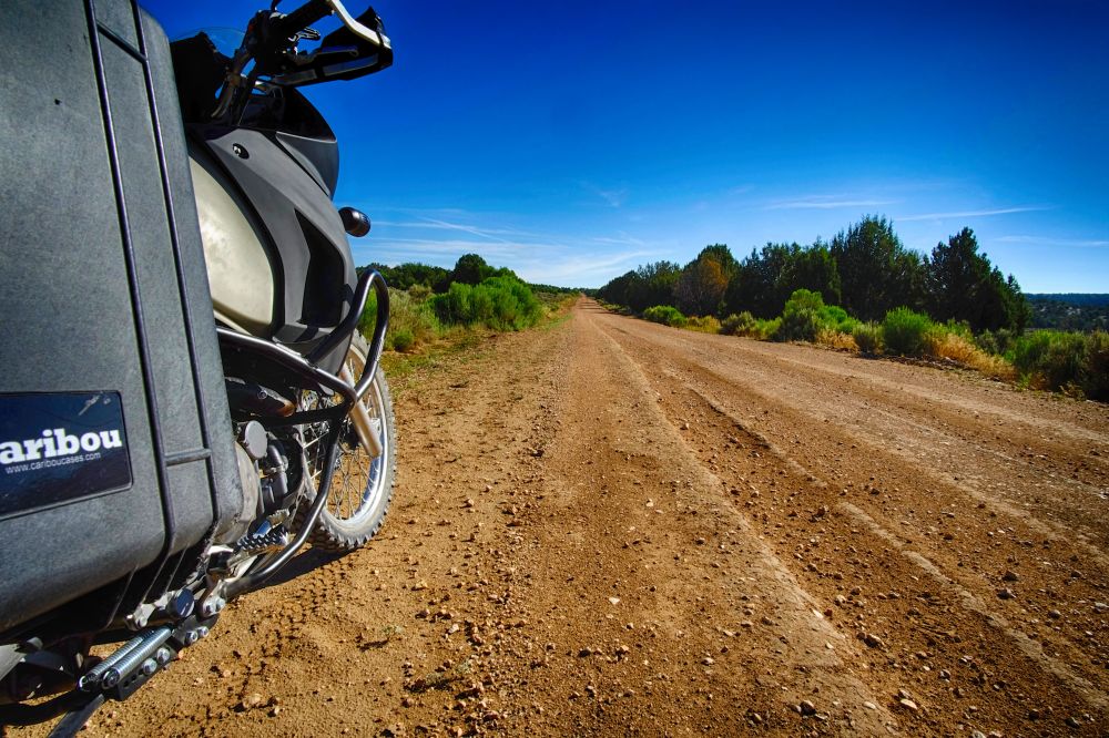
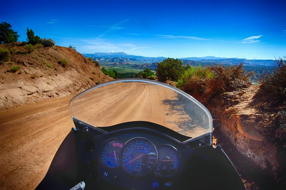
The road heads north and skirt the Escalante-Grand Staircase National Monument where it then crosses into the park after Deer Springs Ranch. A lot of it looks like this.
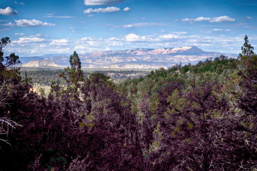
Along the way you’re treated to a ribbon of red Navajo Sandstone that traipses along the southern exposed Mesozoic cliffs of Bryce Canyon.
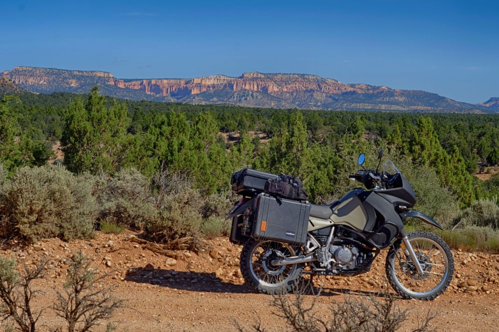
While Skutumpah goes on for about twenty two miles on smooth grade, much of it bordering private ranch land, it eventually enters the Grand Staircase National Monument where it turns into tight corners and rapid descents into Bull Valley Gorge. Just before it does so it treats you to a view of Kodachrome Basin.
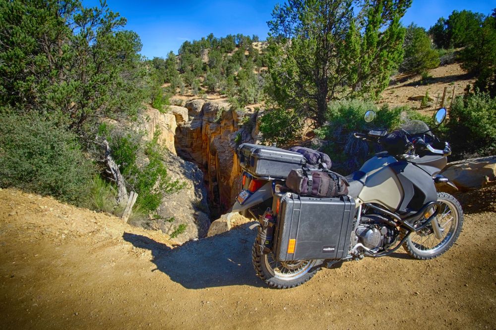
A quick descent takes the road into the Bull Valley Gorge gaping under BLM 500, surprising in its sudden occurrence and depth, perhaps the reason in 1954 when a pickup truck missed the wooden bridge that once crossed this crevice and plunged into the gap killing its three occupants. The remains were recovered with great difficulty but the truck remains down there.
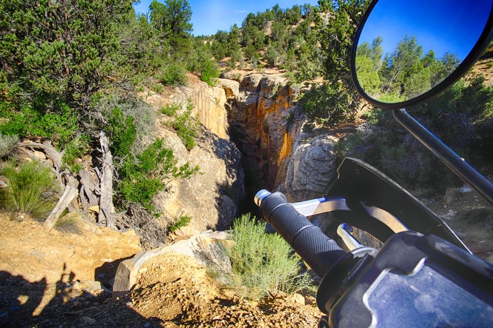
The wooden bridge has since been replaced by large boulders and dirt wedged into the gap, though you wouldn’t notice it if you didn’t know otherwise. I’m unconvinced that is any more reassuring.
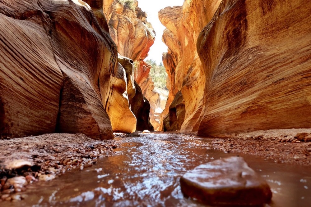
A little under two miles north from the gorge is the trailhead to Willis Creek Slot Canyon.
This is the part of Skutumpas that is the most traveled bringing curious tourists and hikers in from the Kodachrome side of the Grand Staircase. A mile or so before the road joins Cottonwood Canyon Road it makes this sandy descent.
Not too long after, breakfast was waiting in Tropic.
This commute didn’t end they way I had planned with yet another flat rear tire. I joined I-15 at Spanish Fork, merged into the HOV lane and by the time I hit Orem the KLR was undulating underneath me. With rush hour in full bloom I couldn’t negotiate the barely-controllable bike to the right shoulder over five lanes of traffic and an onramp at mile marker 273, so I hugged the concrete barrier dividing the freeway and called my wife in North Salt Lake for help.

She rounded up her brother who has a trailer to come retrieve me and the KLR. The UHP stopped and set up a traffic control zig-zag with one cruiser while another escorted me across the northbound lanes as I pushed the KLR to a safer spot to load it up and take home to North Salt Lake.
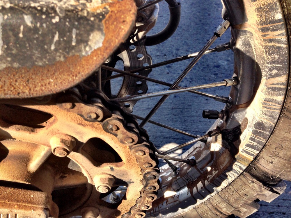
Not the best ending of this commute, but it certainly could’ve been a lot worse. I wrote that very same sentiment in my last post, but I don’t want to get used to writing that. Time to dig into the rear wheel and see why I’m losing tubes back there.